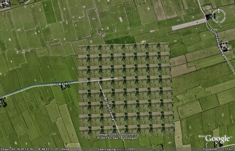
Schon jetzt lassen sich mit
Google Earth so einige interessante Dinge erkennen und im Ausnahmefall sogar ein
sonnenbadender Student entdecken. Doch solche Dinge könnten demnächst gerade lächerlich sein, denn die Qualität der Bilder wird sich demnächst deutlich verbessern. Das, und häufigere Updates, erwartet man sich jedenfalls von neuen Satelliten.
Die Firma
DigitalGlobe, einer der Hauptfotolieferanten für Google Earth, schießt morgen den neuen Satelliten
WorldView I ins All und wird demnächst richtig scharfe Bilder schießen. Der Satellit ist zum größten Teil vom US-Verteidigungsministerium finanziert worden und wird nur zur nebenbei-Finanzierung Fotos an Google senden, allerdings stark zensiert - dennoch ausreichend für eine sehr große Qualitätsteigerung.
Im schlechtesten Fall hat Earth zur Zeit eine Auflösung von 15 Meter pro Pixel, mit dem neuen Satelliten wird uns Google Fotos liefern die auf
50 cm genau sein werden. Zwar schießt der Satellit Fotos mit einer sehr sehr (sehr) viel besseren Auflösung, aber Google Earth hat leider die Auflage nicht mehr als 50 cm pro Pixel anzuzeigen - von daher werden die Bilder genau bis zu diesem Punkt heruntergestuft - aber auch das reicht noch vollkommen aus.
Außerdem könnte der Update-Intervall sich stark erhöhen, da der neue Satellit dazu in der Lage ist an nur einem einzigen Tag
600.000 km² zu Fotografieren, der alte Satellit hat für diese Leistung eine ganze Woche gebraucht. Hoffen wir dass Google tief in die Tasche greift und alle verfügbaren Fotos einkaufen wird.
»
Artikel bei SPON
[thx to:
urmelchen]
 Gemeinsam mit dem Zapfsäulenhersteller Gilbarco Veeder-Root wird Google demnächst an dem Netz mit 3500 Tanstellen in den USA Kartendienste an der Zapfsäule anbieten. Neben Kartendaten sollen auch Informationen zu Hotels, Restaurants und Sehenswürdigkeiten zur Verfügung stehen. Weiß der Kunde schon wo er hin will, kann er auch die berechnete Route ausdrucken lassen.
Wie wir beobachten können, bietet Google so immer mehr Möglichkeiten an, auch in der Offline-Welt ohne High-Tech Navigationssysteme in den Genuß der Google-Dienste zu kommen, bis das ganze schließlich Einzug in die Alltagswelt der Handy und Autonavigationssysteme gehalten hat.
Und wer bei der Initiative nach Einnahmequellen fragt, wird überrascht sein, denn Google wird auf dieser Plattform zunächst keine Werbung anbieten. Es handelt sich also um eine reine Eigenwerbung für Googles Kartenprodukte.
Die Webseite von Gilbarco Veeder-Root und die offizielle Pressemeldung
[Winfuture.de]
Update
Hier werden die Partner angekündigt: Google und SMART Merchandising? System
 Update 2
Die offizielle Ankündigung

 Nachdem die Panormaio Bilder direkt in Google Earth integriert wurden sind nun YouTube Videos dran, denen eine Geo-Position zugeordnet ist. Surfer auf Thaiti, Pinguine in der Antarktis oder Löwen in Afrika. Die Welt läßt sich nun wieder einmal völlig neu entdecken...


 Am gestrigen 19. September 2007 gab es ein Update bei den Fotos von